
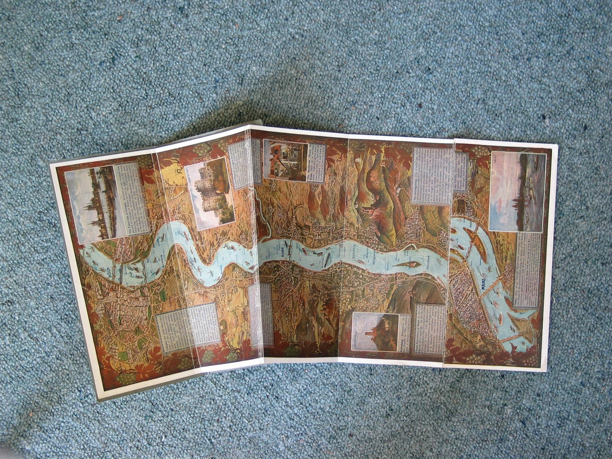


Highly coloured and detailed illustrated map of the Rhine from Cologne to Mainz. Published as a propaganda tourist product by the Nazis before WW2. Very long. folded and presented in a 112mm x 257mm folder.
| Date | c. 1936 |
|---|---|
| Dimensions (mm) | 185 x 242 |
| Condition | Very good. Paper. Printed colour. |