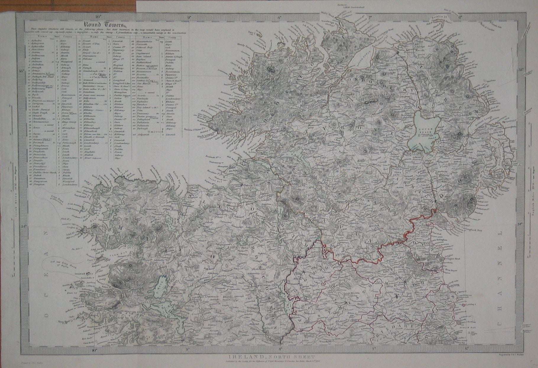
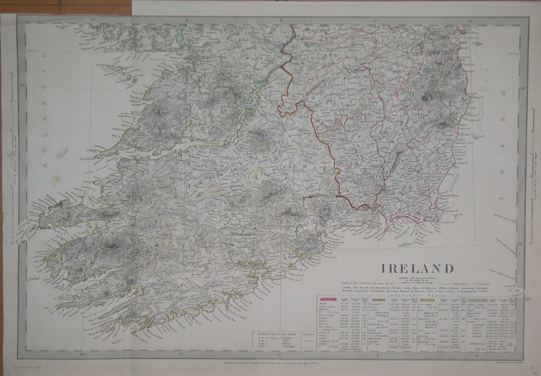
These two finely engraved 1838 maps are extremely detailed. Published by The Society for the Diffusion of Useful Knowledge(SDUK). Provincial and county boundaries are shown together with towns, villages, rivers and relief shown with hatching. A very attractive pair of maps.
| Cartographer | J & C Walker |
|---|---|
| Date | 1838 |
| Dimensions (mm) | 467 x 314 |
| Engraver | J & C Walker |
| Place | 59, Lincolns Inns Fields, London |
| Publication | 1844 Atlas of SDUK maps |
| Publisher | Society for the Diffusion of Useful Knowledge |
| Condition | Good. Both maps have a vertical fold down the left hand side and a segment cut from the top left hand corner - these maps being taken from an atlas. |